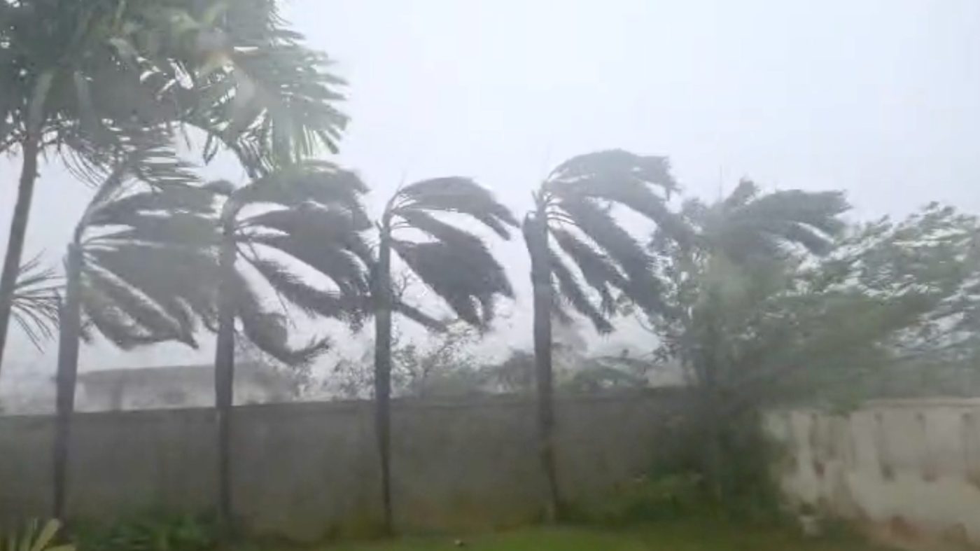
Typhoon Sinlaku, now the most powerful tropical cyclone recorded this year, is delivering a severe blow to American territories across the Western Pacific. The storm, which rapidly intensified to peak winds of 185 mph, made direct impacts on the Northern Mariana Islands early Wednesday local time before being downgraded from super typhoon status.
The National Weather Service in Guam reported maximum sustained winds have decreased to 145 mph, but the storm remains extremely dangerous. Typhoon-force winds extend 75 miles from its center, with tropical storm conditions reaching 265 miles outward. The system is moving northwest at just 5 mph, prolonging the period of intense rainfall and wind exposure for the islands.

Catastrophic Flooding and Evacuation Challenges
Forecasters predict between 15 to 20 inches of rainfall for Tinian and Saipan, with 6 to 12 inches expected for Rota. This deluge has triggered widespread flash flood warnings across the remote U.S. territories. The NWS warns of storm surge reaching 5 to 8 feet above ground level, with wave action potentially driving water levels even higher along vulnerable coastlines.
Saipan Mayor Ramon "RB" Jose Blas Camacho described dire conditions to The Associated Press. "It's hitting us hard," Camacho stated. "It's so difficult for us to respond with this heavy rain, heavy wind to rescue people. Objects are just flying left and right." The mayor's comments underscore the operational challenges facing local emergency services during the storm's peak.
Extreme Warnings and Population Impact
The Weather Service issued an extreme wind warning for Saipan and Tinian, urging residents to "treat these imminent extreme winds as if a tornado was approaching and move immediately to an interior room or shelter NOW!" This level of warning reflects the unprecedented intensity of the storm system.
The affected territories are home to significant American populations, with approximately 47,329 residents in the Northern Mariana Islands and about 153,836 in Guam according to 2020 Census data. A meteorologist with the weather service warned during a broadcast that many residents "will wake up to a different island" following the storm's passage.
The Guam Joint Information Center warned that sustained winds of 40 to 60 mph with higher gusts would continue through Wednesday morning, posing "risk to public safety, infrastructure and power lines." Officials have urged all residents and visitors to remain indoors until conditions improve. The storm's impact on critical infrastructure could have lasting implications for the territories' stability and economic activity.
This severe weather event occurs amid broader discussions about federal preparedness and climate resilience. The storm's rapid intensification follows patterns noted in recent scientific assessments of Pacific weather systems. As global powers navigate complex geopolitical tensions, including conflicts that draw international focus such as the recent escalation in Beirut, natural disasters in strategically significant regions test governmental response capabilities and alliance commitments.
The aftermath of Sinlaku will likely prompt examination of disaster readiness in America's Pacific territories, which serve as important strategic locations. The recovery effort may intersect with ongoing policy debates about infrastructure investment and climate adaptation, particularly as public confidence in environmental management reaches record lows. How federal agencies coordinate with territorial governments in the coming days will be closely watched by regional allies and adversaries alike.