As rescue crews scoured the debris-strewn valleys along the Nepal-China border, geologists turned to satellite imagery to piece together the sequence of events that unleashed catastrophic flooding on Wednesday. The deluge claimed hundreds of lives in Nepal and Tibet, with hundreds more—including foreign nationals and pilgrims—still unaccounted for.
Initial images obscured, clearer view emerges
Geomorphologists Kristen Cook of the Université Grenoble Alpes and Dan Shugar of the University of Calgary said early satellite passes were hampered by cloud cover and dust kicked up by the disaster. They could only discern that a portion of a glacier had broken off from Langtang Lirung peak, near the border with Tibet. But by Thursday, clearer imagery revealed a far more dramatic scenario: the bedrock beneath the glacier had itself collapsed, dragging the ice mass down and sending boulders and ice cascading into the valley below.

“It shows the whole area without anything hidden, and we could see that, yes, it looked like there was not only this glacier that had failed, but a much larger chunk of the bedrock of the mountainside itself that had given way,” Shugar said. “You have this big bedrock failure that took part of the glacier with it.”
Devastation downstream
Shugar described the view downstream as heart-wrenching, with images showing how the debris has buried villages. After the mass slammed into the valley floor, it retained its momentum through the steep, narrow gorge as ice rapidly melted, said Cook. Water and mud several stories high then surged through communities, overwhelming everything in their path.
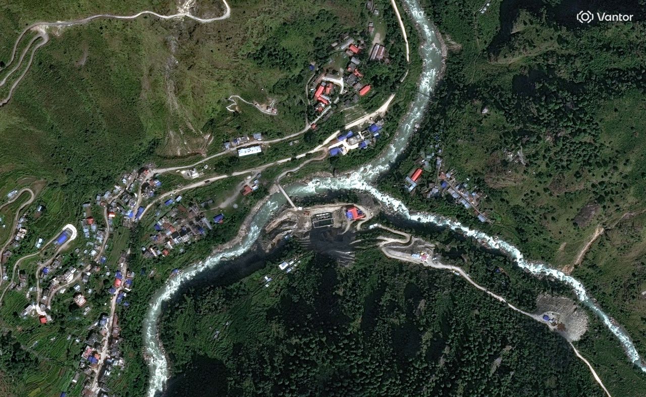
The Trishuli River swelled dramatically. Before-and-after satellite images of the Kolpurtar, Betrawati, and Syapru Besi areas show the river now much wider, its waters turned brown and black. In some stretches it overtopped its banks; in others it became clogged with debris. Cook noted the color change—from greenish to a muddy brown—indicates the immense sediment load the flow carried.
Towns and villages along the riverbanks are now submerged under debris and mud, visible as brown swaths in the imagery. Some structures still poke through in the Betrawati area. In Syapru Besi, a popular trekking gateway to Langtang, buildings were toppled or swept away, and a side river also widened because the flood's force pushed water upstream.
Alton Byers, a mountain geographer at the University of Colorado Boulder's Institute of Arctic and Alpine Research, called the flooding “a wasteland in its wake” that will take years to recover from. Byers, who lived in Nepal and returns annually to study glacial hazards, said this is by far the largest glacier flood he has witnessed.
Climate change debate
Byers believes the disaster is linked to climate change. Warming temperatures are melting glaciers and permafrost, destabilizing high-altitude rock and ice, and can trigger cascading events. “All the indicators, to me, point to the impacts of warming trends,” he said. “In this case, the permafrost that for millennia has helped to hold together high-altitude rock and ice and soil and glaciers is now weakening and becoming unstable.”
However, Cook and Shugar cautioned that a direct climate link cannot yet be confirmed. Slopes fail and landslides occur naturally, Cook said, though she acknowledged that melting permafrost is destabilizing mountainsides. “While we cannot at this point directly link this collapse to climate change, it is not unexpected to see more events of this type with a warming climate,” she said. “Not this big, hopefully not this big.”
The disaster has drawn international attention, with many foreign nationals among the missing. The nearly 90 Americans missing has added a diplomatic dimension to the crisis. As the death toll surpasses 380, the full scale of the tragedy is still unfolding.