Federal forecasters are sounding the alarm over a looming El Niño pattern expected to take hold by mid-2026, with significant implications for coastal flooding and weather disruptions across the United States. The National Oceanic and Atmospheric Administration (NOAA) now places the odds of El Niño emerging between May and July at 82%, with a 96% probability that the climate phenomenon persists through the winter of 2026-2027.
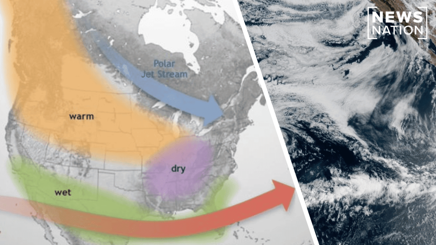
El Niño, the warm phase of the El Niño-Southern Oscillation (ENSO), disrupts typical weather patterns by shifting the Pacific jet stream southward. This redirection of the air current can elevate sea levels along the West Coast and funnel additional rainfall into the Gulf Coast and Southeast. Historically, stronger El Niño events have been linked to increased high-tide flooding, an effect that has become more pronounced in recent decades due to rising baseline sea levels.

How El Niño Alters Coastal Dynamics
During an El Niño, trade winds over the Pacific weaken, triggering Kelvin waves—large, planetary-scale waves that move eastward along the equator and up the West Coast. Unlike typical waves that curl and break, Kelvin waves propagate without crashing, warming the upper ocean and raising sea surface temperatures for months. This process can push water levels higher along the coastline, exacerbating tidal flooding in vulnerable communities.
NOAA officially declared the end of La Niña, El Niño’s cooler counterpart, which had dominated recent years. The two phases cycle every two to seven years, with a neutral phase in between characterized by near-average sea surface temperatures. The shift to El Niño marks a significant reversal in the climate system.
Possibility of a ‘Super El Niño’
Matthew Sittel, assistant state climatologist at Kansas State University, noted that there is a chance the event could escalate into a “super El Niño,” defined by ocean temperatures at least 2 degrees Celsius above normal. Only four such super El Niños have occurred since 1950. NOAA estimates roughly a 50% probability that the 2026 event could become a strong one, but Sittel cautioned that spring forecasts are notoriously unreliable, and a strong El Niño does not guarantee extreme weather outcomes.
While the forecast carries high confidence, meteorologists emphasize that El Niño’s evolution remains difficult to predict, especially during the spring predictability barrier. The agency will continue to monitor sea surface temperatures and atmospheric conditions in the coming months.
For context, the potential for a super El Niño has been a growing concern among climate experts. As forecasters previously warned of surging odds for a super El Niño by mid-2024, the current outlook underscores the persistent volatility in the ENSO cycle.
Meanwhile, the broader implications for emergency preparedness are significant. Coastal states may need to bolster infrastructure against repeated flooding. In a related vein, 20 states have recently scored high on health emergency readiness, but climate-driven flooding adds a new layer of complexity to disaster response planning.
The coming months will be critical for policymakers and local officials as they assess risks and allocate resources. With a strong El Niño potentially on the horizon, the window for preparation is narrowing.