As the Pacific Ocean heats up toward what forecasters call a “super” El Niño, the Atlantic may be heading in the opposite direction—toward an unusual cooling event known as an Atlantic La Niña.
Franz Philip Tuchen, an assistant professor at the University of Miami’s Department of Ocean Sciences, told Nexstar that while it’s too early to declare it official, parts of the Atlantic are already showing cooler-than-normal temperatures. “If this event persists, there is a high chance of an Atlantic Niña forming,” Tuchen said.
Unlike its Pacific counterpart, which occurs every few years, Atlantic La Niñas are rare. Tuchen noted that only one such event has been recorded in the last quarter-century—the 2025 Atlantic Niña—and that the planet appears to be entering a period of more frequent extreme climate events. “We don’t really know why there are some decades or multiple decades with reduced events and some decades or multiple decades with increased events,” he said. “But we are certainly again in an era of more extreme events.”
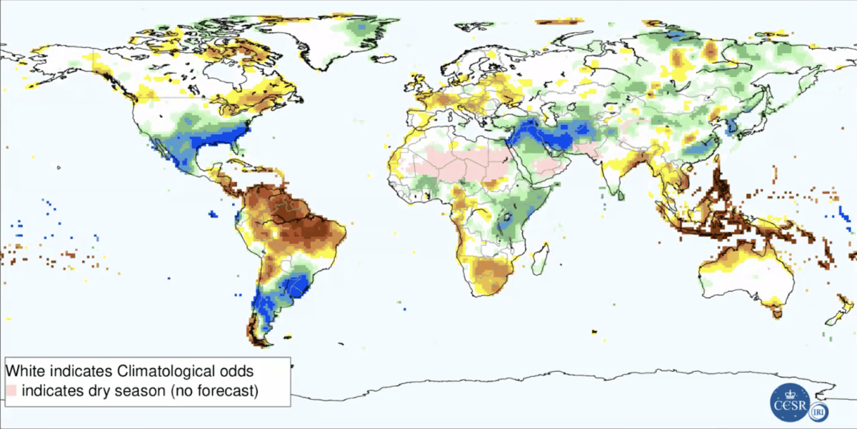
Scientists will need to gather more data through the summer before officially confirming an Atlantic La Niña. If it does materialize, its effects are expected to be smaller in scale than those of a Pacific La Niña, but still significant regionally. According to Tuchen, Atlantic La Niñas typically bring increased rainfall to West Africa and the Sahel, while reducing precipitation over northeastern Brazil. They also tend to suppress cyclone activity near Cape Verde—a key breeding ground for Atlantic hurricanes. That could mean fewer storms tracking toward the Caribbean and the U.S. Gulf Coast.
Meanwhile, the super El Niño strengthening in the Pacific is already drawing attention. The Climate Prediction Center estimates an 81% chance that this year’s El Niño will become “very strong” by early winter, potentially ranking among the most powerful events since 1950. In the U.S., El Niño typically drives a warmer, drier winter across the northern tier and the Ohio Valley, while the southern half of the country sees above-average rain and snow.
Though separated by thousands of miles, the Pacific and Atlantic are not isolated systems. Tuchen explained that the two oceans interact through atmospheric teleconnections. The warming in the Pacific, for instance, can strengthen easterly winds over the Atlantic, triggering wave activity that cools the ocean surface—potentially fueling an Atlantic La Niña. “There is definitely a connection between the Pacific and the Atlantic through the atmosphere,” he said. “Events in both oceans can be generated independently, but even if that is the case, at some point there will be interaction through the atmosphere.”
The simultaneous emergence of a super El Niño and an Atlantic La Niña would be a rare climatic juxtaposition, underscoring the growing volatility in global weather patterns. As Tuchen noted, the recent uptick in extreme events—from record heat waves to unusual ocean temperature swings—suggests that such dual phenomena may become more common in the years ahead.