The Federal Emergency Management Agency's review council released its final report on May 7, sparking debate over sweeping proposals to overhaul disaster programs and shift the National Flood Insurance Program toward private insurers. But tucked inside the document is a more immediate concern: the council's call for FEMA to overhaul its flood-risk data and update maps to reflect modern conditions.
In essence, the report demands that the government tell Americans the truth about where flood danger actually exists. That recommendation is long overdue, analysts say.
FEMA Administrator Deanne Criswell acknowledged the problem in a September 2022 CNN interview, stating plainly that the agency's flood maps do not account for extreme rainfall. She noted that the maps focus on riverine and coastal flooding, leaving out the kind of deluges that have become routine. Her message was clear: people need to understand their real risk.
The technical failures are well-documented. FEMA's Flood Insurance Rate Maps were designed as regulatory tools, not precision risk assessments. Many areas still rely on rainfall data from the 1970s. When the National Oceanic and Atmospheric Administration updated its rainfall predictions in 2018, it found that extreme 24-hour events in Texas were 2 to 3 inches heavier than the state's 2011 maps assumed. Yet, the maps never changed. Fewer than half of all mapped miles use modern light detection and ranging elevation; the rest depend on decades-old surveys with 20-foot contour intervals. Less than 1 percent include any forward-looking data on sea-level rise, heavier precipitation, or urbanization, despite a 2012 mandate that remains unmet.
The result is a systematic undercount of flood risk. The First Street Foundation found that FEMA's special flood hazard areas understate properties at significant risk by more than two-thirds. Nearly 30 percent of all National Flood Insurance Program claims come from properties the maps classify as low risk.
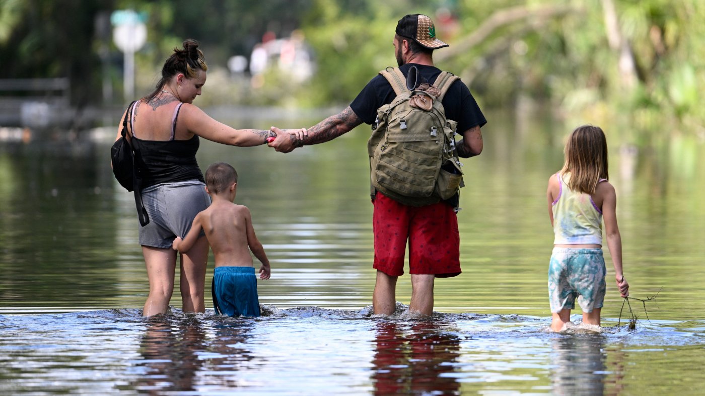
That misclassification carries real-world consequences. At flood-map hearings, residents often insist they've lived in a neighborhood for decades without flooding. But after Hurricane Helene in 2024, areas like Pinellas County, Florida, and Buncombe County, North Carolina, saw homes that had never flooded inundated by four feet of water. Many lacked flood insurance because official maps said they didn't need it. The cost is not just actuarial—it's families standing in floodwater, realizing the government map they trusted was wrong.
Claims data confirms the scale of the problem. An analysis of FEMA's OpenFEMA database shows the National Flood Insurance Program has paid nearly 700,000 claims and $21 billion in losses on properties in non-mandatory low-risk zones. Research from the Federal Reserve Bank of Philadelphia estimates that 70 percent of U.S. flood losses—about $17 billion annually—go entirely uninsured. Between 2010 and 2023, flood damage reached nearly $144 billion, but insurance covered only about $50 billion.
FEMA already has the data to fix this. When the agency rolled out Risk Rating 2.0 in 2021, it used third-party catastrophe modeling to measure flood risk for every home in the country. That data set premiums but never updated the regulatory flood maps. The result: a government that charges homeowners for flood risk it has already measured while its official map still labels the same home low risk. The obstacle isn't data—it's politics. The community review process that accompanies every map revision has become a tool for local interests to contest inconvenient designations. After Hurricane Sandy in 2015, New York City appealed FEMA's proposed new maps. Eleven years later, those maps remain unfinished, and the city relies on maps more than two decades old.
Telling Americans the truth about flood risk is not a partisan issue. It's a property-rights issue and a basic obligation of honest government. Criswell said it on camera in 2022, and the review council has now recommended action. What's missing is the political will to translate what the government knows into what it tells the public—and the discipline to prevent the review process from becoming a veto. Americans deserve to know their actual flood risk, and the families who will lose everything in the next hurricane deserve better than a map built for a world that no longer exists.
This debate comes as other policy battles rage, including public opposition to military engagement in Iran and calls to ban betting on election outcomes. But for millions of homeowners, the flood map issue is a matter of survival, not politics.